This summer, many people will be seeking refuge and recreation in nature, whether hiking along a wooded path or boating out on a lake. While spending time outdoors, we encourage anyone and everyone to report invasive plants, animals, and pathogens they’ve observed. But what actually happens after you submit a report? Read on for a breakdown of how your reports can be used to control and prevent the spread of invasive species.
Reporting Platforms: EDDMapS and iNaturalist
First, let’s explain the behind-the-scenes of two of the key online reporting platforms: EDDMapS and iNaturalist.
EDDMapS, or the Early Detection and Distribution Mapping System, is a platform specifically for invasive species. Reports go directly to experts in the field, who will review all reports and verify that the reported species is correctly identified before it gets added to a distribution map (more on this below!); you might even get an email asking for additional photos to help confirm.
In Ontario, the Invading Species Awareness Program (ISAP) is the province’s verifier. The distribution maps generated by EDDMapS are generally used by professionals such as foresters, public works, researchers, and land managers, but are accessible to the public. If you want to learn more about the invasive species you’re reporting, there are profiles built into the app.
iNaturalist is a platform for logging any species – invasive, native, and naturalized. When observing, there is an AI tool that can help narrow down the potential species. Although reports do not go to experts, there is a community of users that can identify observations, and once two people agree on an identification it is classified as “research grade.” You can also ask other users questions about observations.
All research-grade invasive species observations go through a triage system and are eventually added to EDDMapS. iNaturalist is an excellent tool for the public as they can get more familiar with their natural surroundings in general, and the platform is user-friendly. If you’re not sure what you are looking at is an invasive species, iNaturalist is a great place to start.

Reporting through any platform is very important and helpful. Distribution maps can be used by research scientists, land managers, policy makers, and even the public in a myriad of ways:
Understanding Invasive Species Distribution and Movements
By mapping the distribution of invasive species across geographical boundaries, we can get a better understanding of where they are spreading and establishing. The more reports we get, the more accurate the maps are.
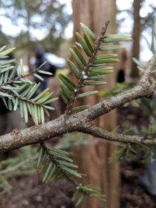
For instance, hemlock woolly adelgid (HWA) is a relatively recent invasive pest in Ontario that has been spreading across southern parts of the province since 2019. Any new reports of sightings (especially if made directly to the Canadian Food Inspection Agency in the case of priority pests like HWA) help to track the spread. HWA is also being closely monitored and tracked in Nova Scotia, where it has been present since 2017. Members of the public, forest managers, and woodlot owners can all contribute to the HWA Monitoring Network.
Reports could also help inform experts on pests that have not yet established in Canada, such as spotted lanternfly (SLF) which poses a threat to the wine and agricultural industries, as well as its host plant, tree-of-heaven, is a widespread invasive plant throughout Ontario but it has not been mapped to a great extent. This may have implications for preparing for the potential arrival of SLF, as this invasive insect has a high preference for feeding on tree-of-heaven. Mapping tree-of-heaven through reports made by members of the public could help us better predict where spotted lanternfly may establish in Canada if it is introduced here.
Site Selection for Research, Management and Outreach
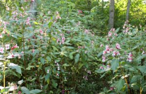
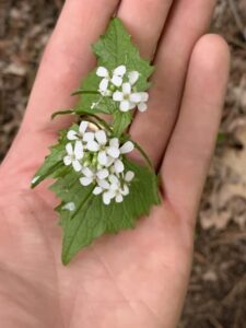
Reports can be used by scientists to inform research on distribution or to locate specimens or trial sites for research. Municipal and conservation authority staff can use maps generated from reports to find patches for management of high priority species, like invasive Phragmites or giant hogweed. Local community groups can refer to these maps as well to determine locations for outreach events, like Himalayan balsam or garlic mustard pulls.
Enacting Rapid Response
Rapid response to high priority introductions of invasive species can be triggered by reports made by members of the public. A good example of this is when someone reported a sighting of an Asian longhorned beetle north of Toronto in September 2003, leading to a successful eradication program.
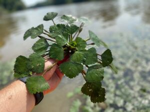
A rapid response program for European water chestnut, an invasive aquatic plant, is in it’s third year in the Welland River thanks to a report to EDDMapS in 2020 made by a recreational paddler.
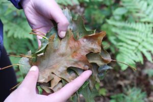
In 2023, a report of oak wilt to the Canadian Food Inspection Agency by an arborist in Niagara Falls led to swift action to remove infected trees and increase monitoring in the area.
Since there are far more community members, hobby naturalists, and industry professionals than invasive species experts that can have their eyes on the ground, the former groups are key to early detection of novel invasive species populations.
Influencing Policy
Invasive species reports have the potential to influence policy at all levels of government, such as amendments to the Ontario Invasive Species Act (2015) or the development of an invasive species strategic plan or management plan for a municipality. By showing what invasive species are spreading and where, reports can help planners and policy makers to prioritize regulations and strategies for management.
Enhanced Learning About the Natural Environment
Since EDDMapS and iNaturalist reports are available to the public, anyone can access these maps to learn about what is in their neighborhoods. Even without directly prompting action, reports of invasive species can contribute to increased ecological literacy and awareness of your natural surroundings.
Conclusion
Reports of all species are important, even if they are species that are widespread. The more you do it, the more you’ll sharpen your own naturalist skills. Plus, you’re contributing real-world data that can inform research, response plans, policy, and management. Have fun this summer and happy reporting!
